טעקע:Map helgoland 1910.jpg

בילד מיט אַן הױכע רעזאָלוציע (603 × 769 פיקסעל, טעקע גרייס: 344 קילאבייטן, טיפ MIME: image/jpeg)
רעזומע
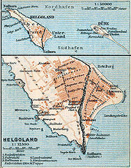
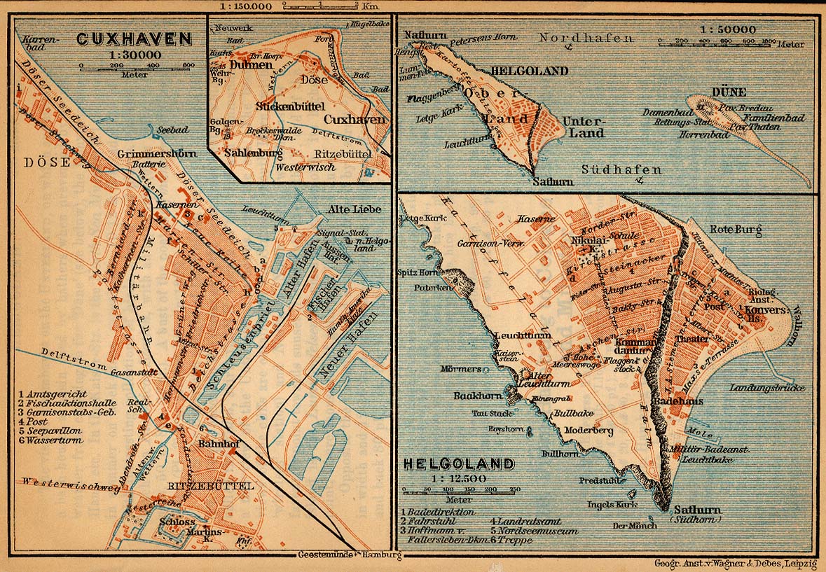
| דעסקריפציע | Map of Heligoland, Germany, 1910 |
| דאַטע | |
| מקור | http://www.lib.utexas.edu/maps/historical/baedeker_n_germany_1910/cuxhaven_helgoland_1910.jpg |
| שרייבער | "Northern Germany as far as the Bavarian and Austrian Frontiers; Handbook for Travellers" by Karl Baedeker. Fifteenth Revised Edition. Leipzig, Karl Baedeker; New York, Charles Scribner's Sons 1910. |
| דערלויבעניש (ווײַטערניצן די דאָזיגע טעקע) |
"Courtesy of the University of Texas Libraries, The University of Texas at Austin." http://www.lib.utexas.edu/maps/map_sites/hist_sites.html |
| אַנדערע ווערסיעס |
Derivative works of this file: Map helgoland 1910 cropped.jpg cut from Image:Map cuxhaven helgoland 1910.jpg |
ליצענץ:
|
יצירה זו נמצאת בנחלת הכלל במדינת המקור ובמדינות אחרות בהם תקופת זכויות היוצרים היא משך חיי היוצר ו-70 שנה (או פחות) מפטירתו.
| |
| הקובץ הזה זוהה כקובץ חופשי מכל מגבלה ידועה תחת חוק זכויות היוצרים, כולל כל הזכויות הקשורות והסמוכות. | |
היסטאריע פֿון דער טעקע
קליקט אויף א דאטע/צײַט צו זען דאס בילד אזוי ווי עס איז דעמאלסט געווען
| דאַטע/שעה | געמינערטע בילד | געמעסטן | באניצער | קאָמענטאַר | |
|---|---|---|---|---|---|
| איצטיקע | 17:28, 23 אַפּריל 2006 | | 769 × 603 (344 קילאבייטן) | 700 MB | {{Information| |Description=Map of Heligoland, Germany, 1910 |Source=http://www.lib.utexas.edu/maps/historical/baedeker_n_germany_1910/cuxhaven_helgoland_1910.jpg |Date=1910 |Author="Northern Germany as far as the Bavarian and Austrian Frontiers; Handbo |
טעקע באַניץ
דער פאלגנדער בלאט ניצט די דאזיגע טעקע:
גלאבאלע טעקע־פארווענדונג
די פאלגנדע אנדערע וויקיס ניצן די דאזיקע טעקע:
- באניץ ביי cs.wikipedia.org
- באניץ ביי en.wikipedia.org
- באניץ ביי en.wikiversity.org
- באניץ ביי eu.wikipedia.org
- באניץ ביי fy.wikipedia.org
- באניץ ביי gl.wikipedia.org
- באניץ ביי ja.wikipedia.org
- באניץ ביי mk.wikipedia.org
- באניץ ביי nl.wikipedia.org
- באניץ ביי nn.wikipedia.org
- באניץ ביי pl.wikipedia.org
- באניץ ביי uk.wikipedia.org
- באניץ ביי vi.wikipedia.org
- באניץ ביי zh.wikipedia.org