טעקע:California map showing Sacramento County.png
נישטא מיט א העכערער רעזאלוציע.
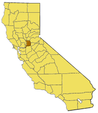
California_map_showing_Sacramento_County.png (200 × 231 פיקסעל, טעקע גרייס: 22 קילאבייטן, טיפ MIME: image/png)
Map of Sacramento county in California. From en:

|
מען גיט רשות צו קאפירן, פארשפרייטן אדער מאדיפיצירן דעם דאקומענט, לויט די באדינגונגען פונעם גנו פֿרייען דאקומענטאציע ליצענץ, ווערסיע 1.2 אדער א שפעטערע ווערסיע פארעפנטלעכט דורכן פרייע ווייכווארג פונדאציע; מיט קיין אומפארענדערלעכע פאראגראפן, און קיין פאדערשטע אדער הינטערשטע דעק טעקסטן. א קאפיע פונעם ליצענץ איז איינגעשלאסן אינעם אפטייל גנו פֿרייער דאקומענטאציע ליצענץ. |
| די טעקע ווערט ליצענצירט אונטער דער Creative Commons Alike 3.0 Unported ליצענץ. | ||
| ||
| תבנית רישוי זו הוספה לקובץ כחלק מעדכון רישיון GFDL. |
היסטאריע פֿון דער טעקע
קליקט אויף א דאטע/צײַט צו זען דאס בילד אזוי ווי עס איז דעמאלסט געווען
| דאַטע/שעה | געמינערטע בילד | געמעסטן | באניצער | קאָמענטאַר | |
|---|---|---|---|---|---|
| איצטיקע | 15:23, 14 יולי 2005 | | 231 × 200 (22 קילאבייטן) | Pyramide~commonswiki | Map of Sacramento county in California. From en: {{GFDL}} Category:Maps of counties in California |
טעקע באַניץ
דער פאלגנדער בלאט ניצט די דאזיגע טעקע:
גלאבאלע טעקע־פארווענדונג
די פאלגנדע אנדערע וויקיס ניצן די דאזיקע טעקע:
- באניץ ביי en.wikipedia.org
- Rusch Botanical Gardens
- Stone Lake (California)
- Jensen Botanical Gardens
- Template:SacramentoCountyCA-geo-stub
- Robla, Sacramento, California
- Valley View Acres, Sacramento, California
- Ben Ali, Sacramento, California
- Upper Land Park, Sacramento, California
- Carpenter Hill
- Antelope High School
- Sutterville, California
- Swanston Estates
- Grand Island (California)
- Andrus Island
- Twitchell Island
- Paintersville, California
- Ryde, California
- Sloughhouse, California
- Michigan Bar, California
- Sunset Lawn Chapel of the Chimes
- Norristown, California
- Natomas East Main Drainage Canal
- Sutter Island
- West Island (California)
- Dead Horse Island
- Tyler Island (California)
- Brannan Island
- Ida Island
- Long Island (California)
- Montezuma Island
- Randall Island
- באניץ ביי pam.wikipedia.org
- באניץ ביי www.wikidata.org